Last year, a friend from Seattle and I met up in Zermatt for some hiking fairly early in the alpine summer season, so I made an effort to get some hiking in both after work and on weekends. This year, neither my work schedule nor the weather has been particularly cooperative, so in addition to being rarer, ascents if the sun has even peeked around some clouds have been… moodier.
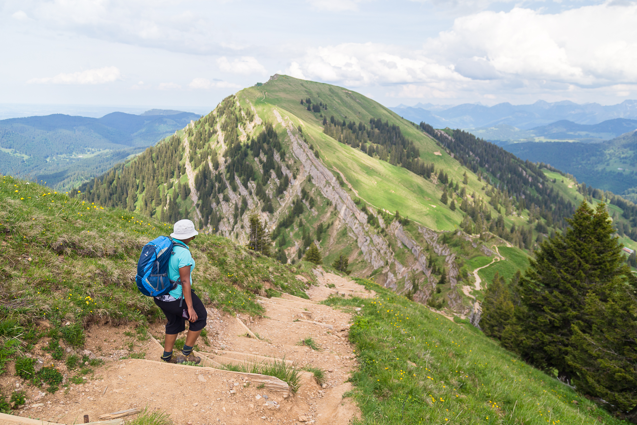
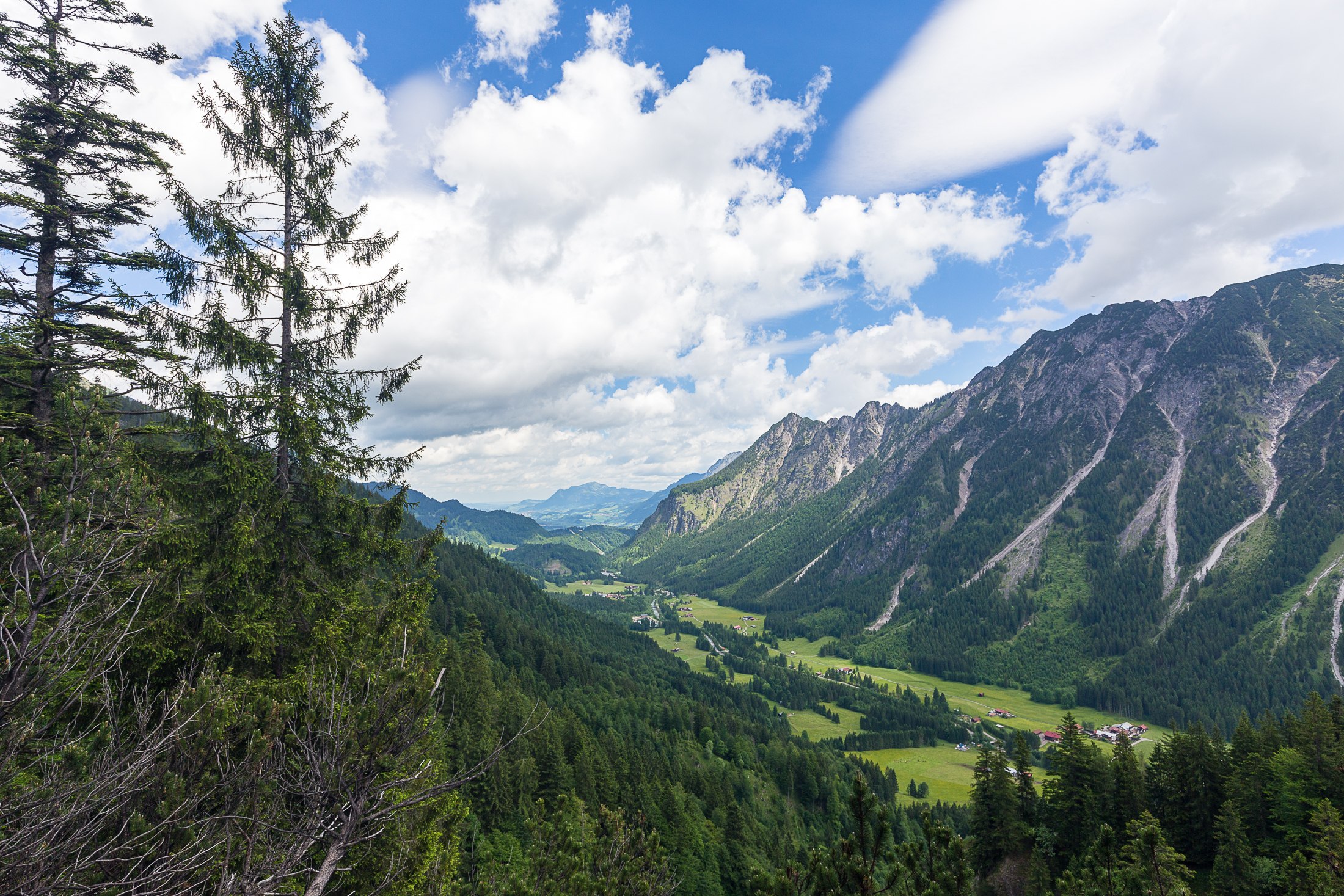
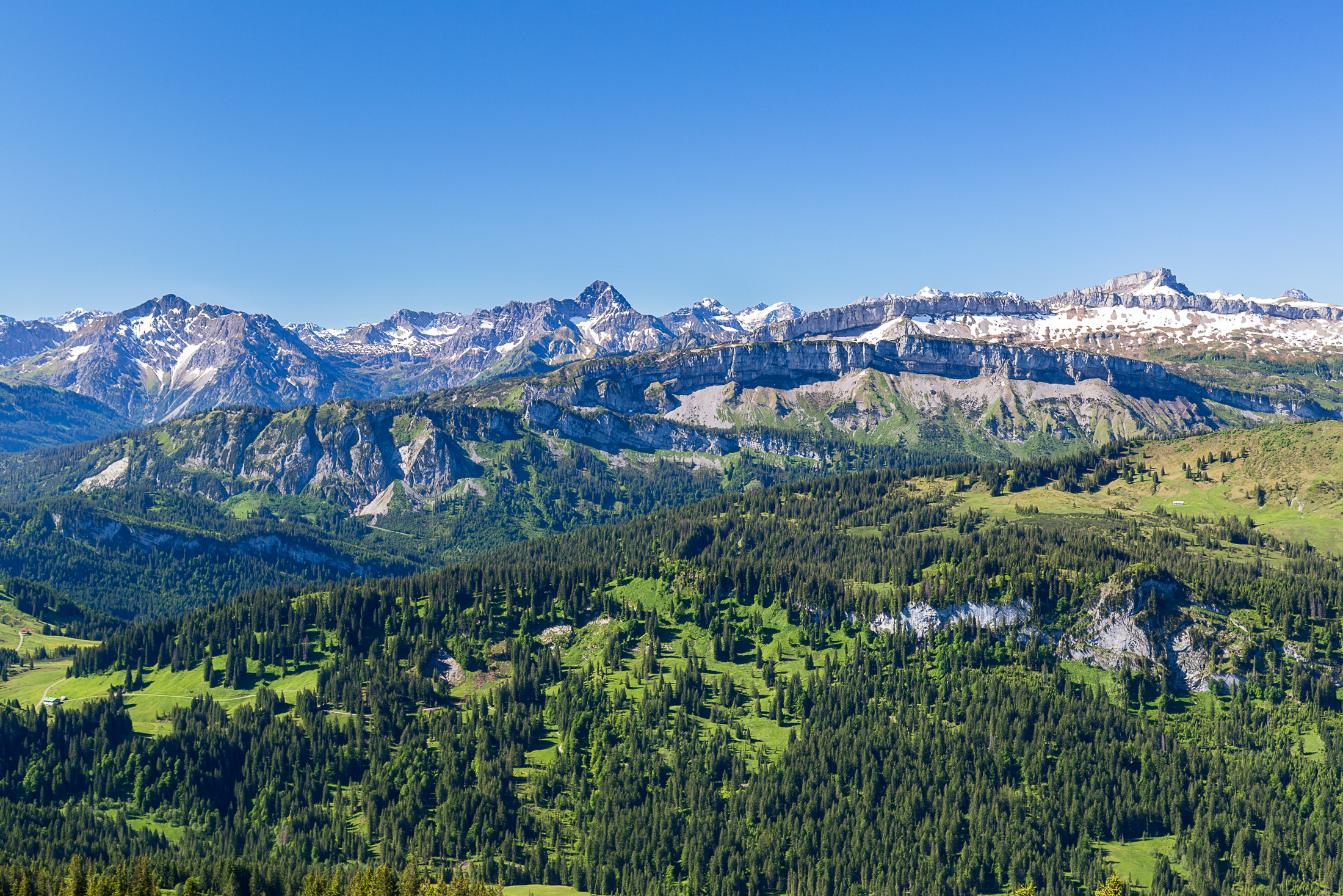
Among the many peaks of the Nagelfluhkette is Hochgrat, the highest peak of the range and a few kilometers further along than Steineberg and Stuiben. It’s not so much further south that the Allgäuer Hochalpen seem closer, but on a breezy Saturday it was nevertheless a welcome reprieve from days of rain.

The trail up to Hochgrat from Scheidwangalpe, which is even further buried in the Gunzesrieder Tal, was not too steep, and we happened to choose a route up that gave us views all day.
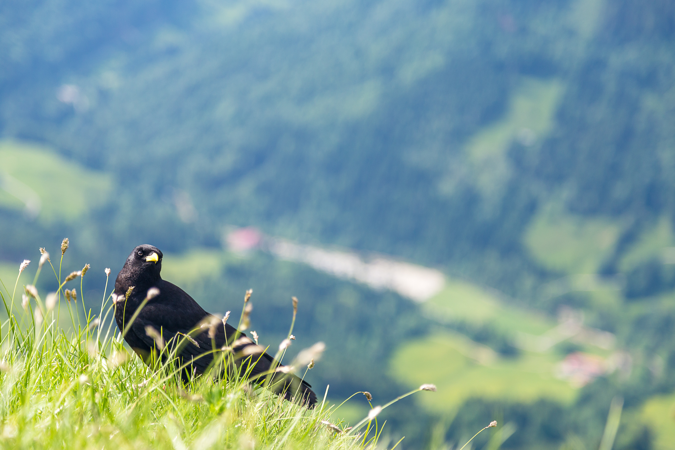
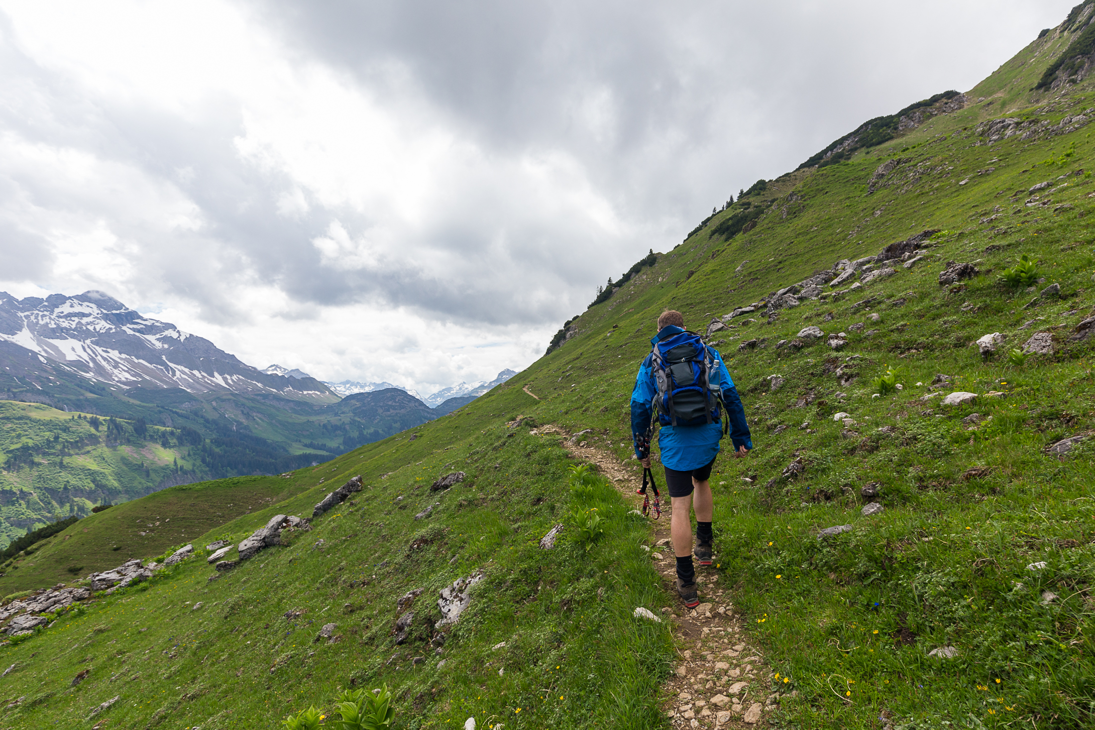
While this summer hasn’t been universally sunny, it has been quite warm on a few occasions. This weekend was no exception, and being another 5500 feet above the valley floor made things a little more comfortable. Apparently the crows appreciated the breeze and cooler temperatures, too — either that or the food that summit-seekers of this popular hike offered them [too] regularly.
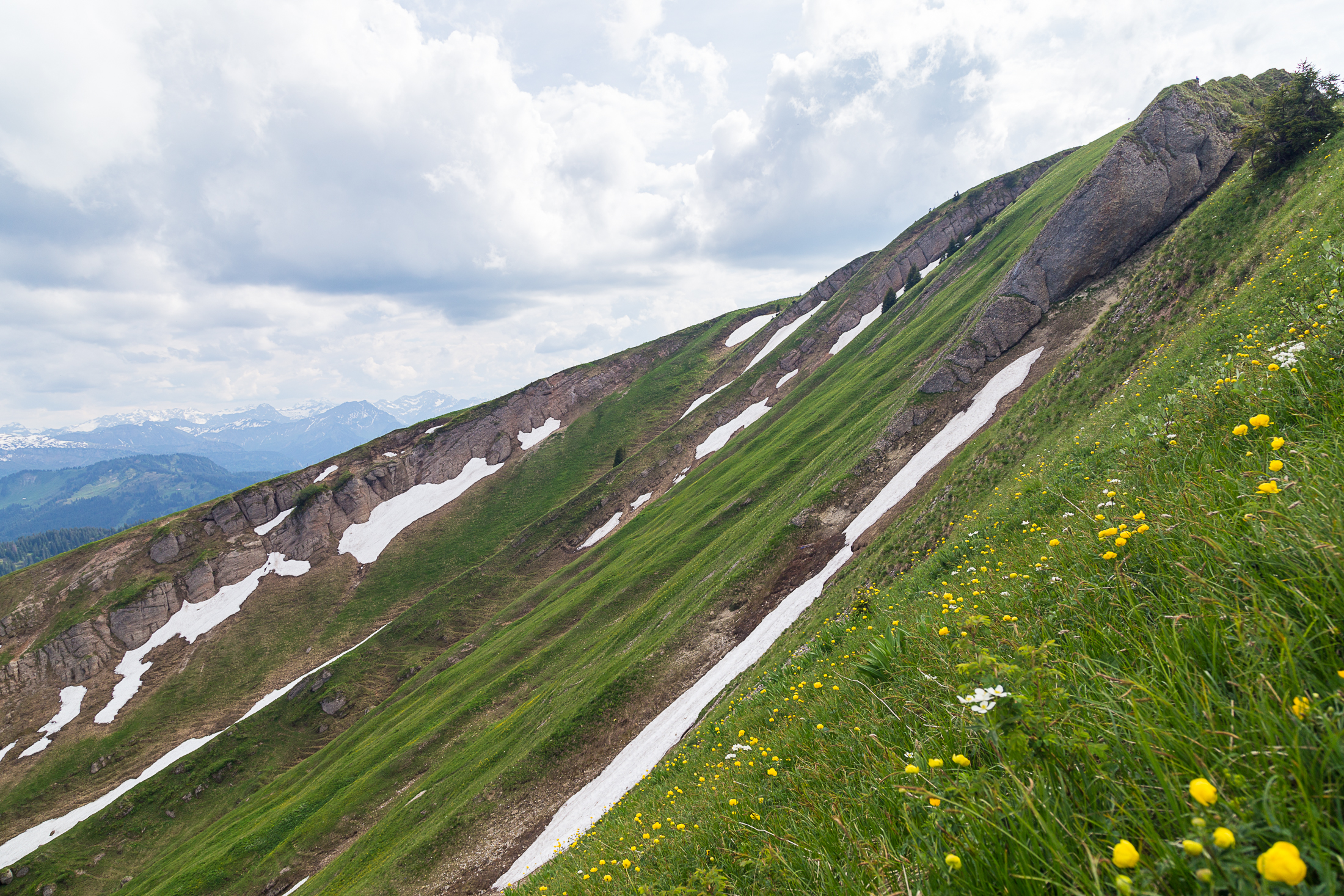
The slopes of the Hochgrat are broad and fairly even, perhaps explaining the presence of a ski lift on its south flank. While it feels like we have more ski areas than Zermatt does, ours don’t feel like quite the tourist-shuttles as the ones there.
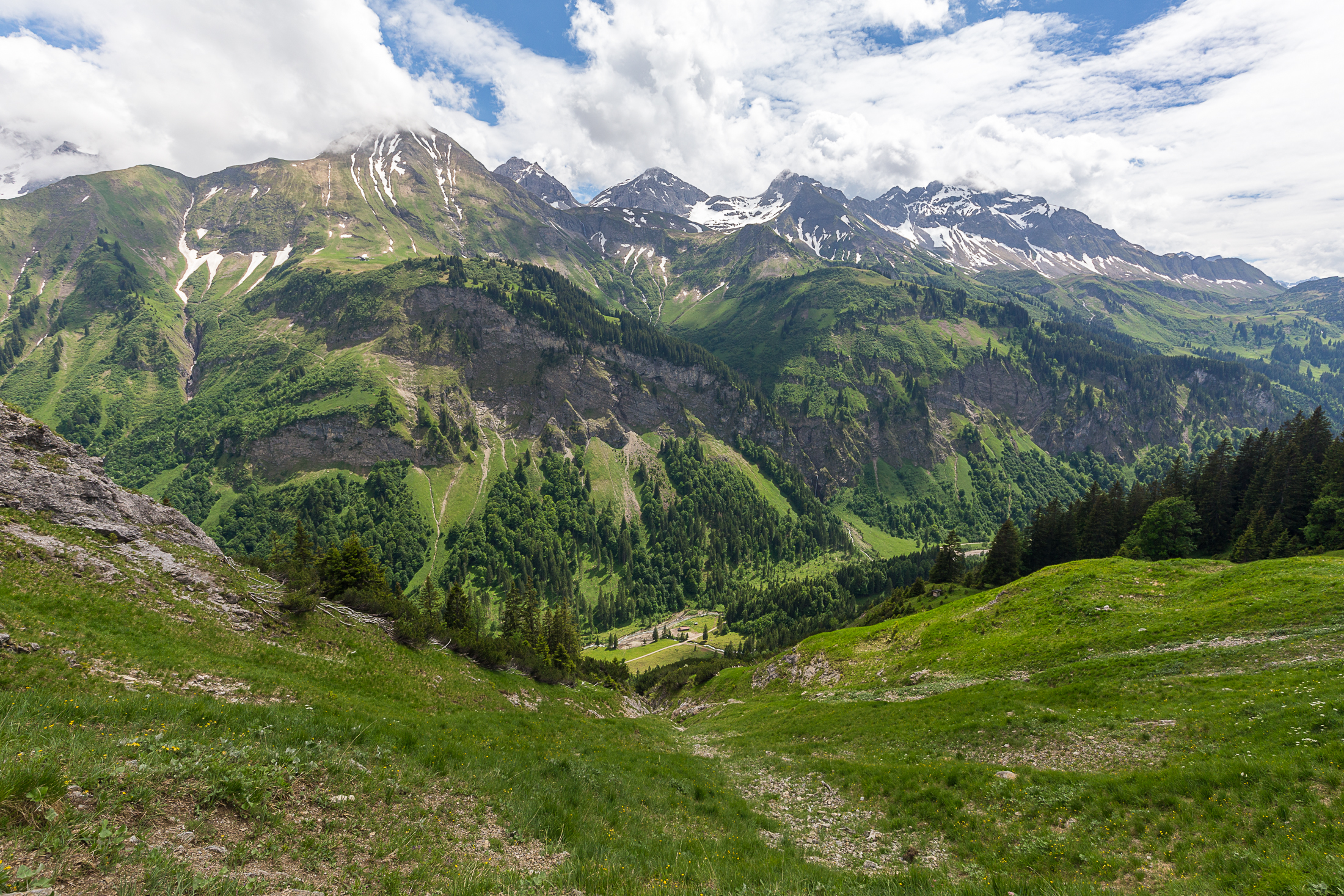
The wife of a fellow expat from Charleston — we’ll be five in this region alone by the time the year ends — joined me for the hike, and as we headed down to the car we contemplated going up the neighboring twin peaks of Gelchenwanger Kopf and Rindalphorn. Eyeing the storm clouds starting to roil in the west, we continued our walk in the sun, progressively getting warmer as we approached the car despite not exerting much energy while heading downhill.
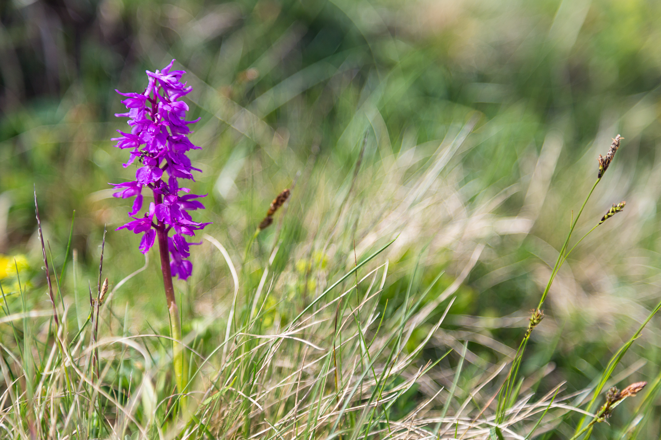
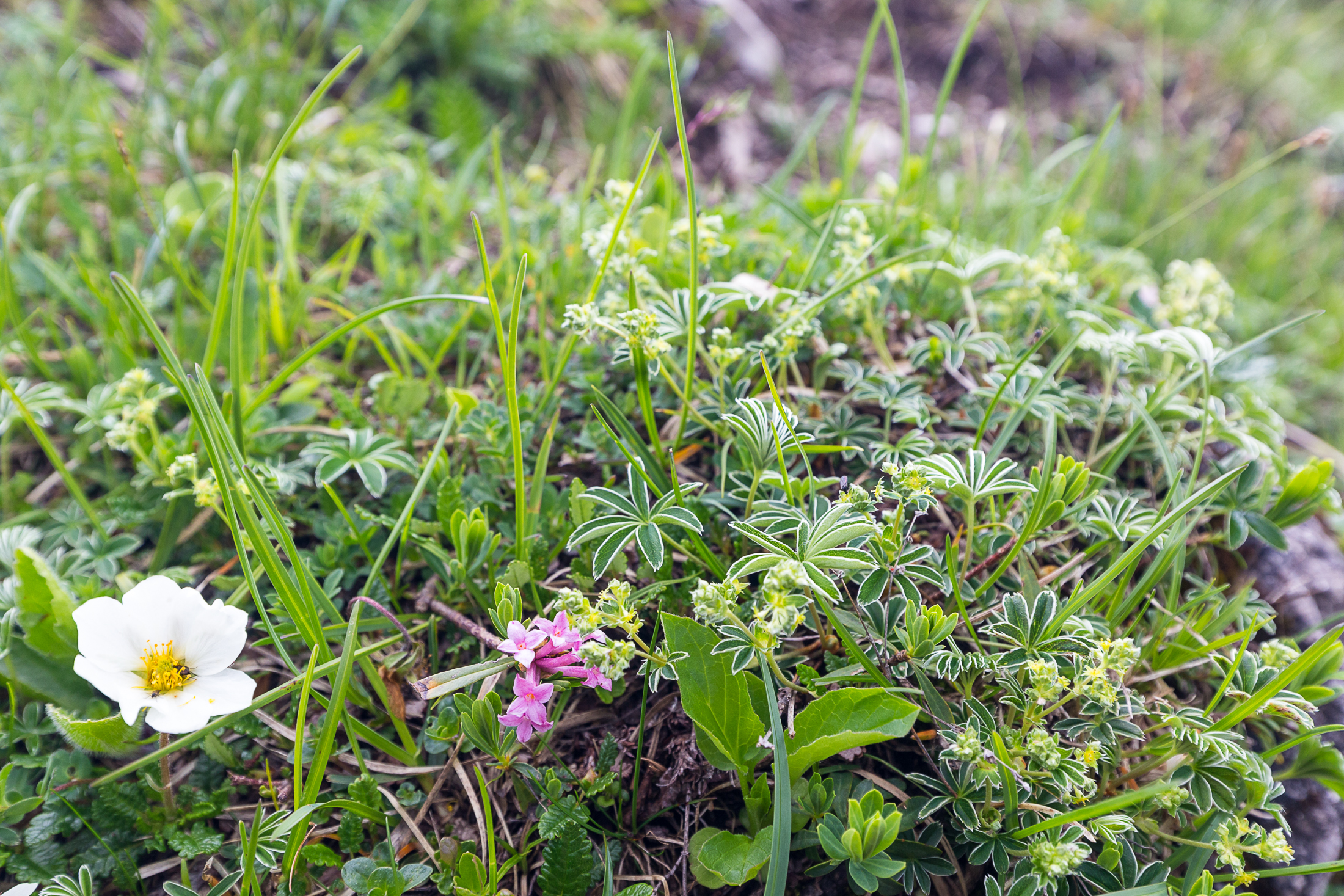
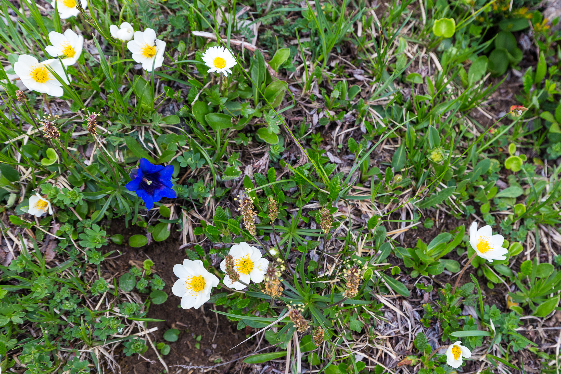
Along the way, we (or I!) stopped a few times to admire the flora. I didn’t remember this much color when hiking in the past, though it would be a recurring theme on other hikes. Seeing little splashes of color amid the monotone green of so many grass slopes was almost refreshing; in a chuckling sort of way it reminds me of us four expats in an area where the predominant culture is very Germanic!
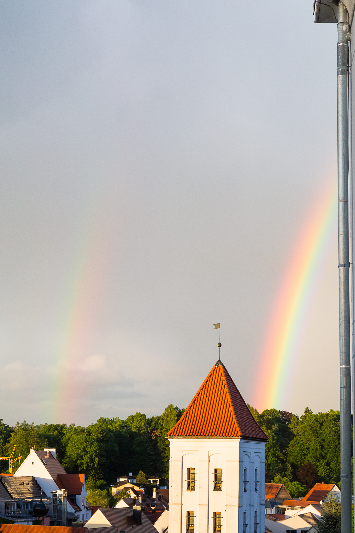
It started to rain within a few days of the hike, though always only in specific spots. Where I live would be completely dry, where my place of work (just 20 km south) would be thundering and pouring. While cooking one evening, I looked out my window to see a vibrant orange mist to the northwest, and craning my head and camera to the east, I saw its effect. Indeed, the skies have been a little temperamental…
A week later, a friend from Stuttgart wanted to go hiking to train for his marathon two weeks later, so I joined him for a romp to Guggersee, a small tarn in the backlands of Oberstdorf. The sky looked to hold as we hiked up, allowing a good view of the Grünten further north.
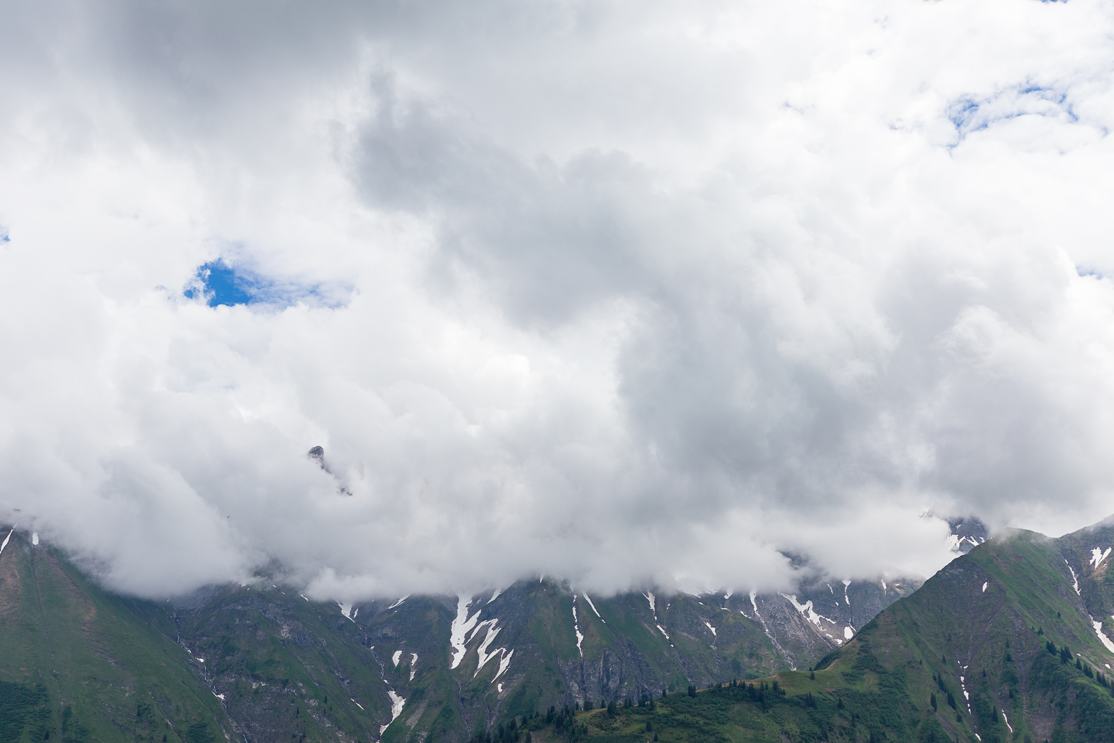
When we arrived at the lake, whose northwest banks were still snow-covered, we found the “Allgäu Trinity” of Trettachspitze, Mädelegable, and Hochfrottspitze just a wee bit clouded over, making it impossible to see a reflection in the lake. “Gugger” is dialect for “having a look” (German gucken), but this time the clouds were toying with the mountains via a game of hide and seek. Despite the coverage, knowing that there is a Allgäu lake with the reflecting prowess of Riffelsee means I might have a closer and cheaper destination for mountain-lake photos than Switzerland.

Across the Stillachtal rain was setting in, so we began our hike down, stopping briefly at a hut along the way to Einödsbach, which is apparently better known than I had realized when I headed there several weeks prior.
During the descent, the clouds began to clear. Photographers typically love this sort of weather — it makes for more dramatic landscapes — but being in it injects just a twinge of surreality; the uncertainty of rain and what the clouds will decide to reveal is a toxic giddiness that isn’t manifested when skies are clear. We lucked out nonetheless and stayed dry for the whole hike.

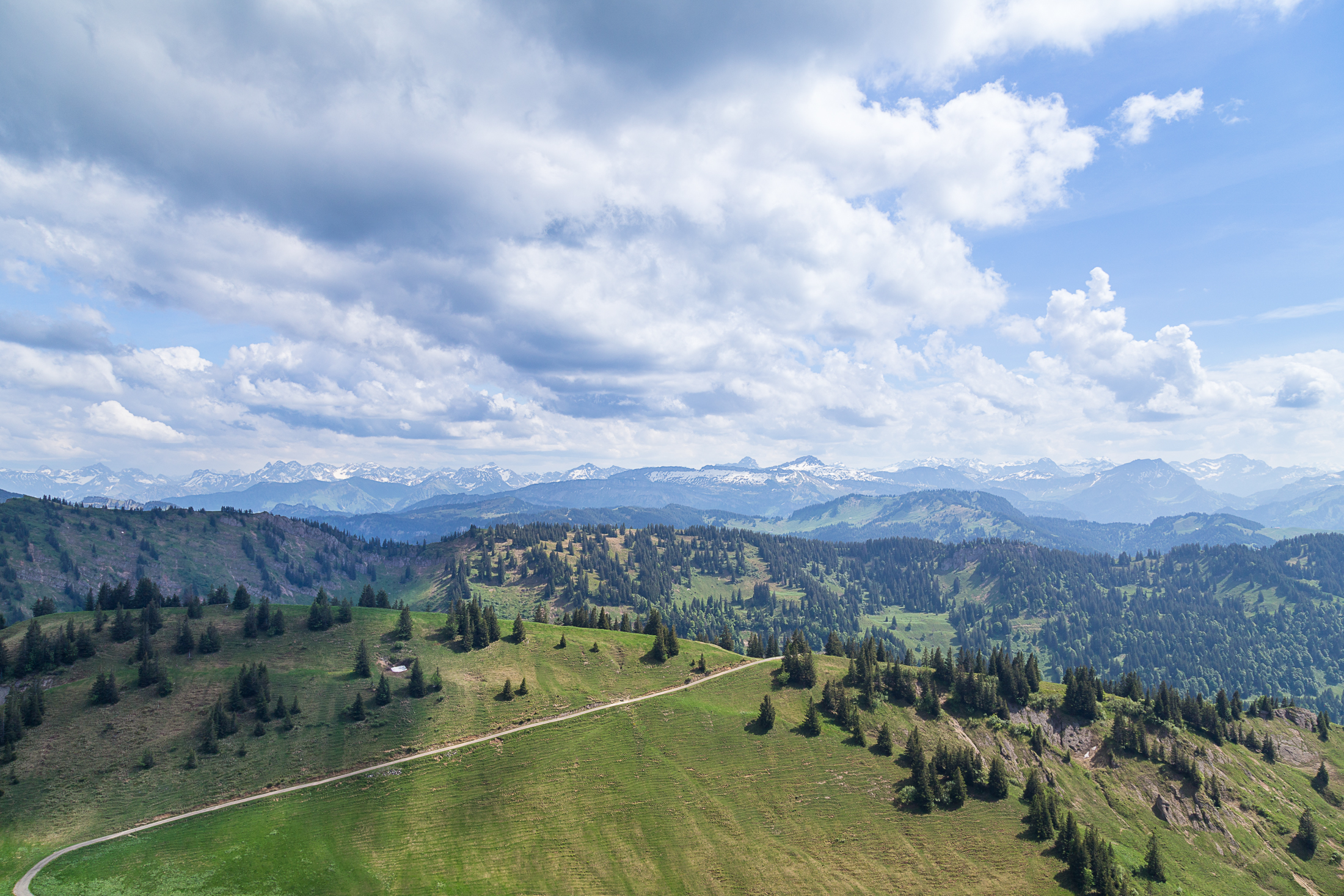
I had organized a hike for the expats at my location for the day after, and with an early summer hike I figured I’d choose an easy trek, deciding without much anxiety on Riedberger Horn. It was a little weird to think that to the day six weeks prior, the whole landscape was under a good two feet of snow. Unlike the previous day, where it was all but impossible to have a shot of only clear sky, that on the day of the hike was completely blue. Ignoring my potential bias with regard to the hike, I’d consider it a success — the entire Allgäu Hochalpen was visible!
Not that the blue skies would last, mind you. As I was preparing dinner that very evening the winds started to pick up, eventually coaxing the clouds to the north into a smooth streak toward sunrise. It was quiet for a few hours, and then the rain drops began pattering on the windowsill all over again.
